
This 3D Model Captures a Rare Tropical Glacier Before It's Gone Forever
Explorer Klaus Thymann raced to document Indonesia's vanishing tropical glaciers near Puncak Jaya, creating a detailed 3D model before they disappear.
Racing Against Time: Documenting the World's Last Tropical Glaciers
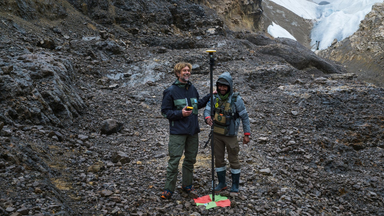
Nearly 15,000 feet above sea level, tucked into the remote highlands of Indonesia, lies a frozen world that most people never knew existed. Near the summit of Puncak Jaya — the country's highest peak — a handful of tropical glaciers cling stubbornly to existence. They are among the last of their kind on Earth, and they are disappearing fast. Explorer, photographer, and scientist Klaus Thymann flew into these highlands last November on a mission that was equal parts scientific urgency and quiet grief: to document the ice before it is gone forever.
Using advanced photogrammetry techniques, Thymann spent several days capturing thousands of overlapping images of the remaining glacial surface. Those images were then stitched together using specialized software to produce a highly detailed three-dimensional model — a digital monument to ice that may not survive the decade. "We stand now to lose these glaciers within a decade," Thymann warned, underscoring just how critical this documentation effort truly is.
Why Tropical Glaciers Matter — and Why Most People Have Never Heard of Them
When most people picture a glacier, they imagine Greenland's vast ice sheets or the frozen flanks of the Himalayas. Tropical glaciers are a far lesser-known phenomenon — patches of perennial ice found near the equator at extreme high altitudes where temperatures can still drop below freezing despite the surrounding tropical climate. They exist in only a handful of places on Earth: the Andes mountains of South America, the peaks of equatorial Africa, and the highlands of Indonesian Papua, where Puncak Jaya rises to 4,884 meters.
These glaciers are scientifically invaluable. They serve as long-term climate archives, with ice cores capable of preserving atmospheric data going back thousands of years. They also act as sensitive indicators of climate change — because they exist in conditions where temperature shifts have an outsized impact, their retreat offers some of the clearest evidence of global warming's accelerating pace. Losing them means losing both a critical scientific record and an irreplaceable natural feature of our planet.
What the 3D Model Reveals
The three-dimensional model Thymann created is more than a visual record. It is a precise scientific dataset that researchers can use to measure the exact volume of remaining ice, track the speed of glacial retreat, and compare current conditions against future observations. By establishing a detailed digital baseline now, scientists gain a tool that allows them to quantify loss with a precision that older photographic or satellite records simply cannot match.
Photogrammetry — the technique Thymann used — works by analyzing the geometric relationships between overlapping photographs taken from multiple angles. When applied at scale across an entire glacier face, it can produce millimeter-accurate surface maps. Combined with GPS reference points established on-site, the resulting model becomes a georeferenced scientific artifact that can be integrated into broader climate research databases.
- The model captures the precise topography of the glacier's current surface extent.
- It provides volumetric data that allows researchers to estimate how much ice mass remains.
- The georeferenced data can be cross-referenced with satellite imagery for longitudinal studies.
- Future expeditions can use the same methodology to measure year-over-year changes with accuracy.
- The model also serves as a permanent public and educational record of a vanishing natural wonder.
The Broader Crisis: Glaciers in Global Retreat
Thymann's expedition is one piece of a much larger, deeply alarming picture. According to research published in recent years, glaciers worldwide are losing mass at rates not seen in recorded history. The World Glacier Monitoring Service has documented accelerating retreat across every major glaciated region on Earth, from the Alps to the Himalayas to the Andes. Some projections suggest that by 2100, two-thirds of the world's glaciers could be gone if greenhouse gas emissions are not dramatically curtailed.
Tropical glaciers are among the most immediately threatened. Because they exist at lower absolute latitudes, the warming signal they experience is amplified by additional feedback mechanisms, including changes in precipitation patterns and increased solar radiation absorption as surrounding vegetation shifts. The glaciers of Puncak Jaya have already lost more than 80% of their surface area over the past century, a staggering decline that has only accelerated in recent decades.
The Human Dimension of Glacial Loss
Beyond the scientific implications, the disappearance of these glaciers carries profound human consequences. In many parts of the world, glaciers serve as critical freshwater reservoirs, releasing meltwater during dry seasons and sustaining rivers that millions of people depend on for drinking water, agriculture, and hydroelectric power. While the Puncak Jaya glaciers are too remote to directly supply downstream communities in the same way Andean glaciers do, their loss contributes to the global hydrological imbalance that increasingly threatens water security across tropical regions.
There is also a cultural and spiritual dimension to glacial loss that is difficult to quantify but impossible to ignore. For indigenous communities across Papua, as for mountain peoples around the world, ice-capped peaks carry deep ancestral and cosmological significance. The erasure of these features from the landscape is not merely an environmental loss — it is a cultural wound, a disruption of the relationship between people and the land they have inhabited for generations.
Why Documentation Projects Like This One Are Essential
In the face of inevitable loss, documentation becomes a form of preservation. Thymann's 3D model ensures that even after the physical ice is gone, its geometry, scale, and scientific data will persist in digital form — accessible to researchers, educators, and future generations who may never have the opportunity to see a tropical glacier in person. Projects like this one also serve a vital advocacy function, making the abstract reality of climate change concrete and visible in ways that statistics and graphs cannot.
Public engagement with climate science depends heavily on compelling, tangible storytelling. A photorealistic 3D model of a vanishing glacier communicates urgency in a way that a graph of global mean temperature anomalies never quite can. It puts a face — or rather, a landscape — on a crisis that too often feels distant and intangible to everyday audiences.
What Comes Next
Thymann has indicated plans to make the 3D model widely available to the scientific community and the public. The hope is that it will not only contribute to ongoing glaciological research but also inspire broader awareness of the speed at which climate change is transforming — and erasing — the natural world. Further expeditions are being considered to continue monitoring the glaciers' retreat and to document other at-risk natural features before they too are lost.
The message embedded in every pixel of that 3D model is both simple and urgent: the window to act on climate change is closing, and the evidence is melting away in real time. Whether in the remote highlands of Indonesia or the ice caps of the poles, the glaciers of our planet are sending a signal that we can no longer afford to ignore.